To locate a geologic map housed in the Lindgren Library, you might have to consult several reference sources. These include the on-line catalog, a card map catalog, map indexes, a book catalog, and GEOREF (a CD-ROM database). The library staff can provide additional assistance.
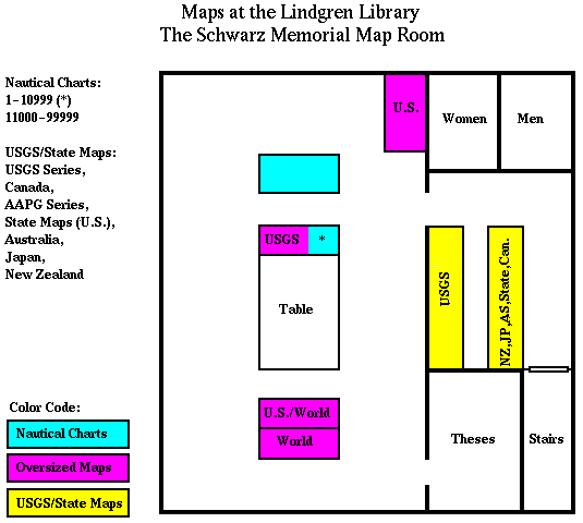
USGS maps are arranged by USGS series at Lindgren Library. They are filed in the USGS map cabinets in the Schwarz Map Room in numerical order within the particular series. To find the series and number of the map you need, consult the Guide to USGS geologic and hydrologic maps (ZG3700 .G8 19xx REF). Under the state name, maps are indexed by 7.5' quadrangle names. To determine the quadrangle name for your area of interest, consult the map indexes stored in the file cabinet in the Reference area.
The card map catalog contains cards for the monographic map collection. These are maps at a scale of 1:500,000 or more. The cards are arranged alphabetically by place name and subdivided by subject. Library of Congress (LC) call numbers are assigned to each map. Maps are stored in the map cases by LC call numbers.
Labelled map cabinets in the Schwarz Map Room contain maps in series. These include Canadian maps, maps issued by state geologic surveys, Geological Society of America (GSA) maps and American Association of Petroleum Geologists (AAPG) maps. Indexes to some of these maps are listed in the Index Maps and Reference Aids section below.
Many geologic maps are included as plates in books. A subject search in Barton and the card catalog under "Geology--place name" will identify the books at Lindgren which cover your area of interest; choose the "Full display" option when viewing a record in Barton to find out whether maps are included in the book. Books which focus on a particular geographic area may be found in the stacks beginning at QE39.
For atlases, use a combined keyword search on Barton: sw=place name
and w=atlas*.
Check the folio shelves at the back of the library for a geological atlas of your area.
Located in the file cabinet in the reference area are folders for each U.S. state which contain various state and USGS map indexes and bibliographies.
The following publications (shelved in the reference area) may be helpful in determining which maps cover your area of interest.
Guide written by Karen Campbell, 8/92. Revised by Lindgren Library Staff, 4/95, 2/96.