Sudbury River Flood
The Sudbury River, in Concord, 2001-03-23, rather far above its banks due to 2 days of heavy rain and melting.
These pictures were taken late in the afternoon, after the rain had pretty much stopped.
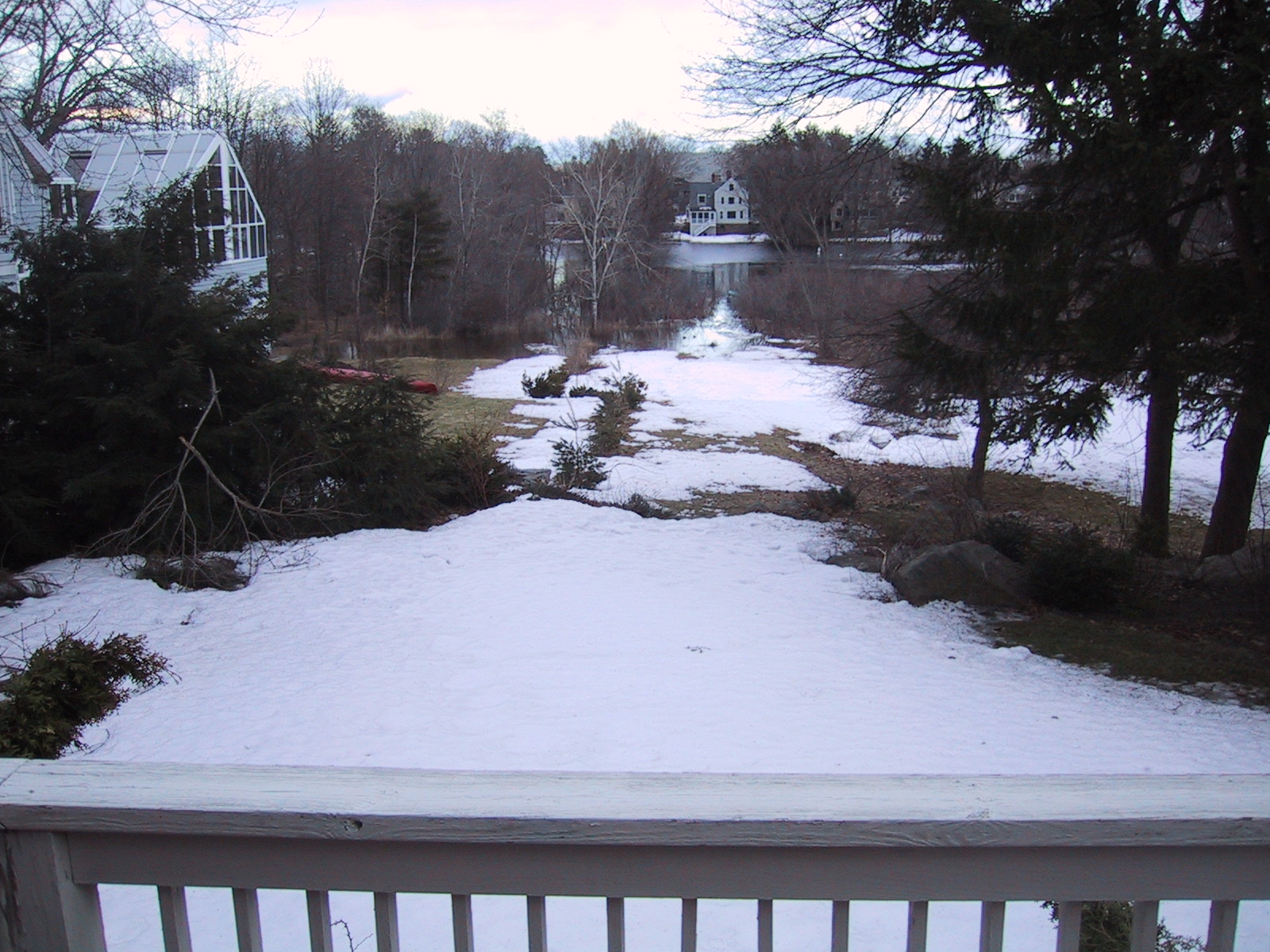
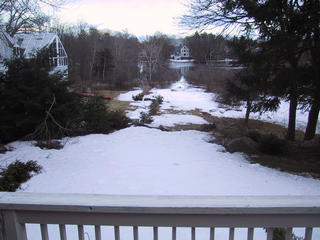 eastward view, facing across the Sudbury River.
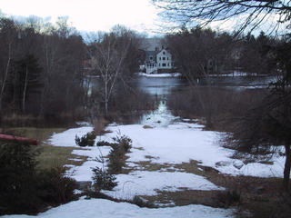 zoomed view east. Note the ducks swimming in the lower flooded area, and note how far up the water is on the lawn of the house across the river.
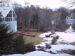 The neighbors rescued their red canoe; the blue canoe is stuck down in the flood area.
 branches squashed or fallen from the preceding slush-storm; no flooding up here, but you might be able to see a bit of the river bend through the trees...
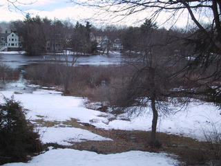 Southeast view, showing the far bank a little better, and the ducks are still there on the left.
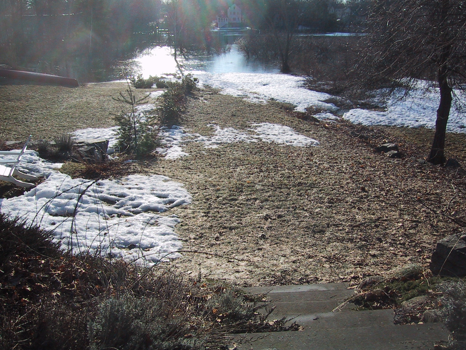
 2 days later, a sunny day around 7AM and more detail. This shot is taken from above the steps, facing east across the river. The part covered in water is about 50% larger than the unflooded part visible here; there is a similar-sized additional area of reeds which is the "official" flood zone.
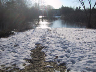 View from the edge of the snow (facing east across the river)
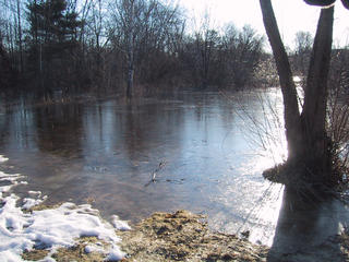 At the edge of the flood, facing northeast. Note that this section is about 3/4" of soft ice over water.
 closeup of the ice layer.
 Closer view of the ice and river, to the east from closer to the edge.
 Looking north along the edge of the flood; Elm St is on the far side of the fence.
 Looking north from the South Bridge, the canoe collection from the South Bridge Boathouse (which is surrounded on three sides by the flood, instead of the canoes being on the dock on the "shore"). Also notable is the next bridge northward (downstream) which is flooded up to the top of the arches. (Previous shots were taken from the upper left.)
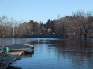 Still looking north, zoomed in to show the height of water on the Elm St. bridge.
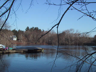 Looking to the northwest, from the eastern end of the South Bridge (note the canoes for reference, and the house on the left which is immediately adjacent to the where the east-facing river shots were taken.)
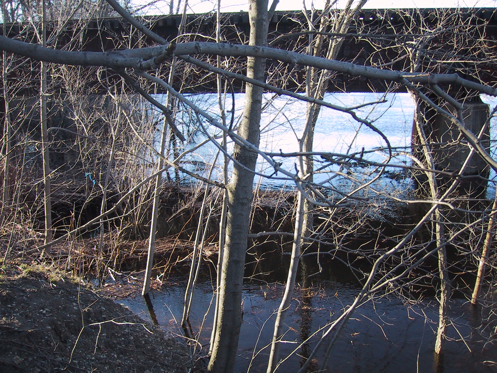
 Looking west along the south (upstream) edge of the South Bridge; Commuter rail bridge to the left, and trees flooded above their forks in between.
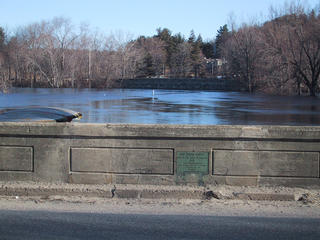 reference shot north-facing from the south edge of the South Bridge, showing the canoes, the next bridge, and the dedication plaque of the bridge itself.
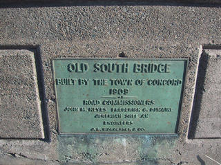 The Old South Bridge dedication plaque (on the north side of the bridge, there is a duplicate on the south side.) Text:
OLD SOUTH BRIDGE
Built by the Town of Concord
1909
Road Commissioners
John M. Keyes Frederick C. Dumaine
Jeremiah Shee An
Engineers
J. R. Worcester & Co.
The Old South Bridge dedication plaque (on the north side of the bridge, there is a duplicate on the south side.) Text:
OLD SOUTH BRIDGE
Built by the Town of Concord
1909
Road Commissioners
John M. Keyes Frederick C. Dumaine
Jeremiah Shee An
Engineers
J. R. Worcester & Co.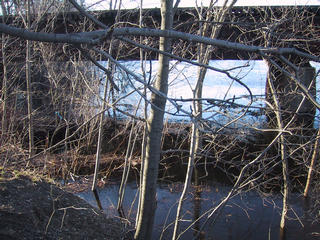 Looking south from the east end of the South Bridge, showing the area under the end of the Commuter Rail bridge completely flooded (normally the left 3/4 of the space is walkable.)
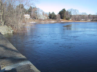 Looking northwest from the Elm St. bridge; this is usually a grassy/reedy area with a shoreline that starts at the stonework to the upper left.
 Looking northeast from the Elm St. bridge. The tree in the foreground is usually on the shoreline, with a lawn behind it.
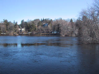 Looking north from the Elm St. bridge; normally the river just meanders through here, curving to the right.
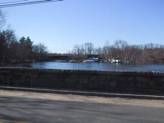 Looking south from the Elm St. Bridge across Elm St. at the Old South Bridge.
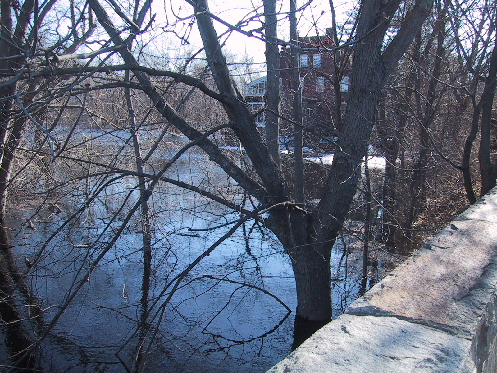
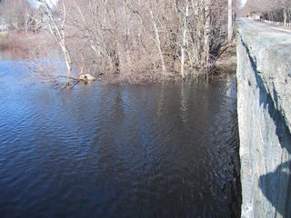 Looking west along the south edge of the Elm St. bridge. This is back along the direction of the earlier shots, which were taken from the far end of the "inlet" visible to the left.
 Looking to the left of the previous shot (looking southwest from the Elm St. bridge; the first run of pictures was taken facing roughly this direction from the center of this.)
 eastward view, facing across the Sudbury River.
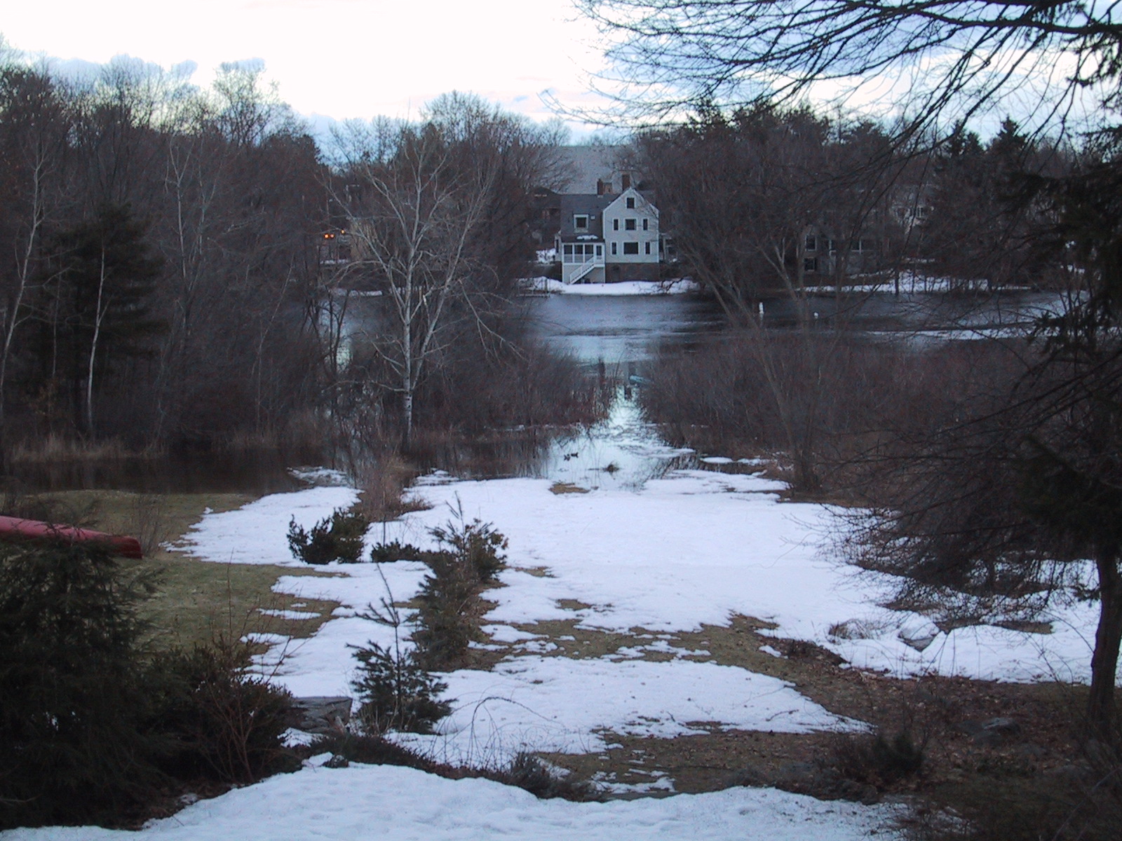 zoomed view east. Note the ducks swimming in the lower flooded area, and note how far up the water is on the lawn of the house across the river.
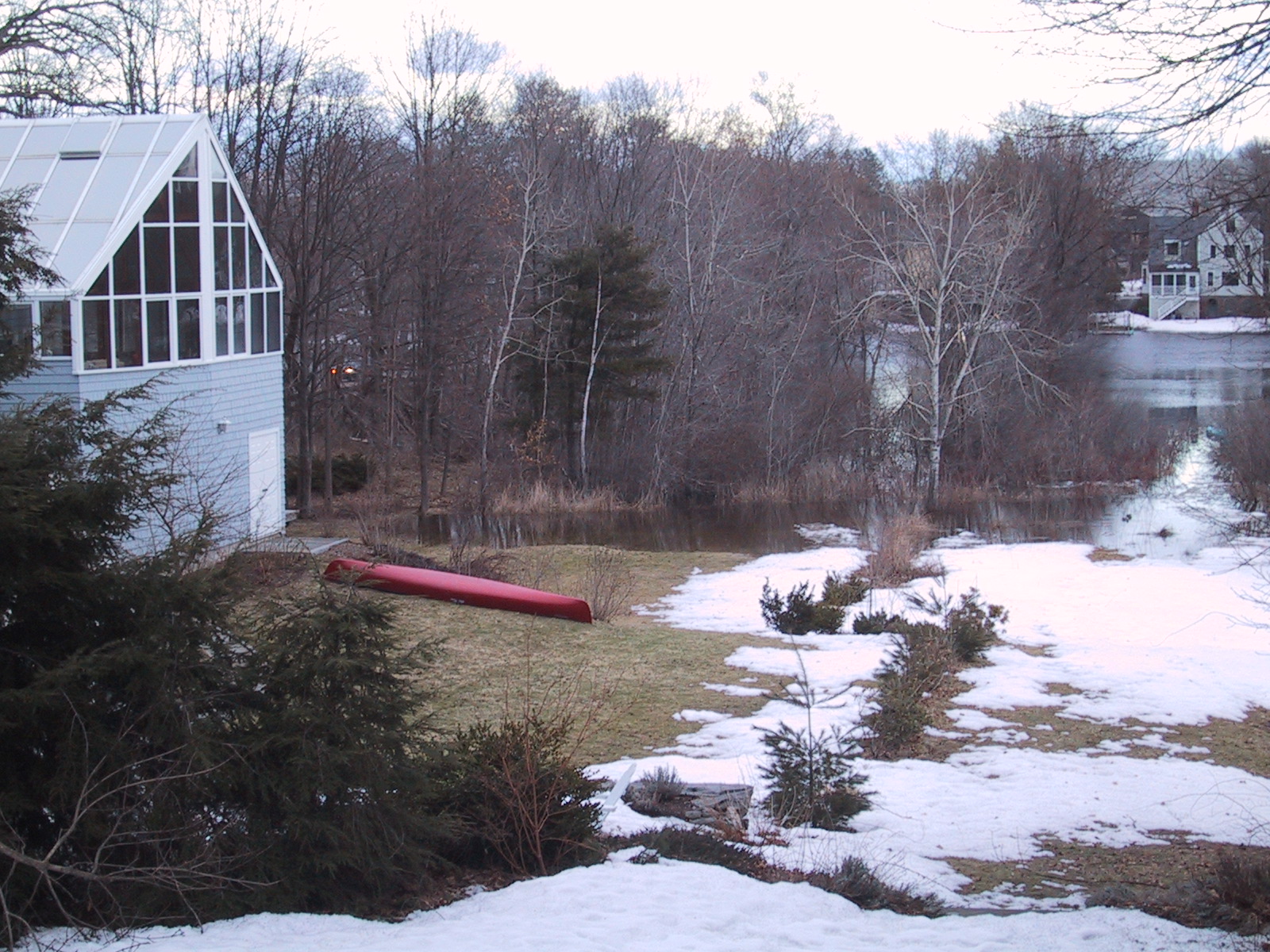 The neighbors rescued their red canoe; the blue canoe is stuck down in the flood area.
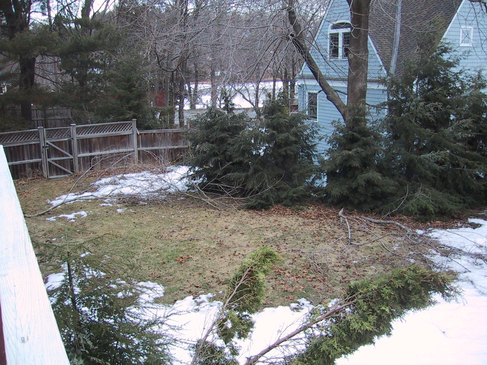 branches squashed or fallen from the preceding slush-storm; no flooding up here, but you might be able to see a bit of the river bend through the trees...
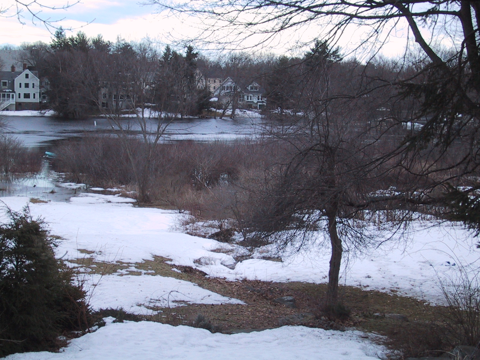 Southeast view, showing the far bank a little better, and the ducks are still there on the left.
 2 days later, a sunny day around 7AM and more detail. This shot is taken from above the steps, facing east across the river. The part covered in water is about 50% larger than the unflooded part visible here; there is a similar-sized additional area of reeds which is the "official" flood zone.
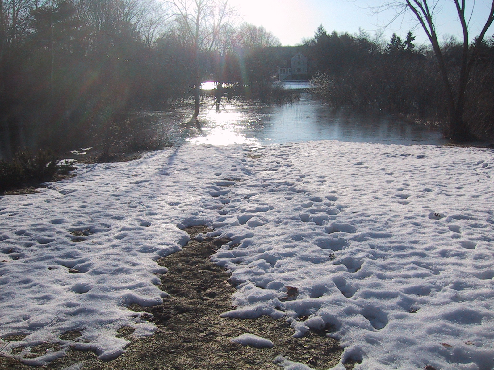 View from the edge of the snow (facing east across the river)
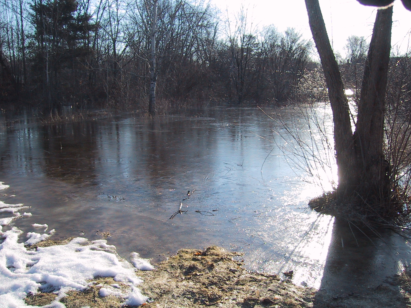 At the edge of the flood, facing northeast. Note that this section is about 3/4" of soft ice over water.
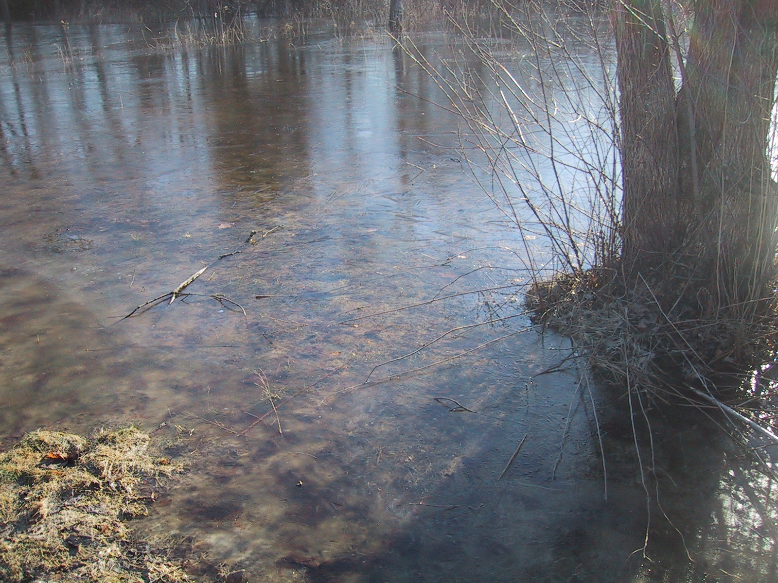 closeup of the ice layer.
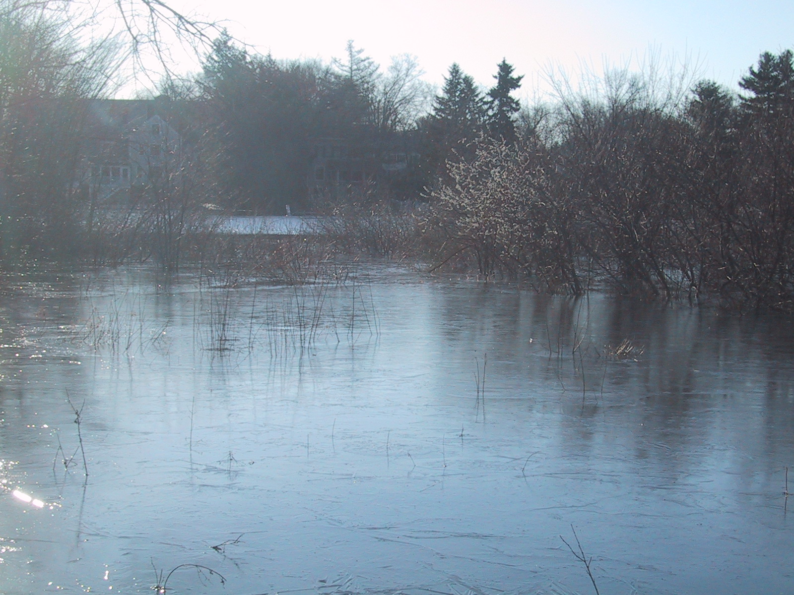 Closer view of the ice and river, to the east from closer to the edge.
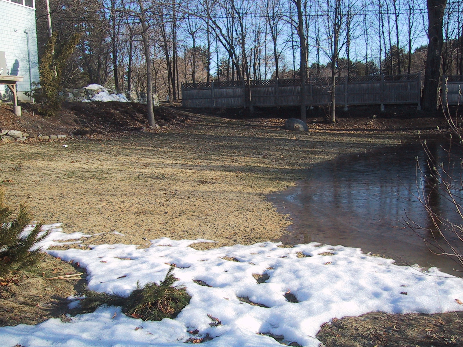 Looking north along the edge of the flood; Elm St is on the far side of the fence.
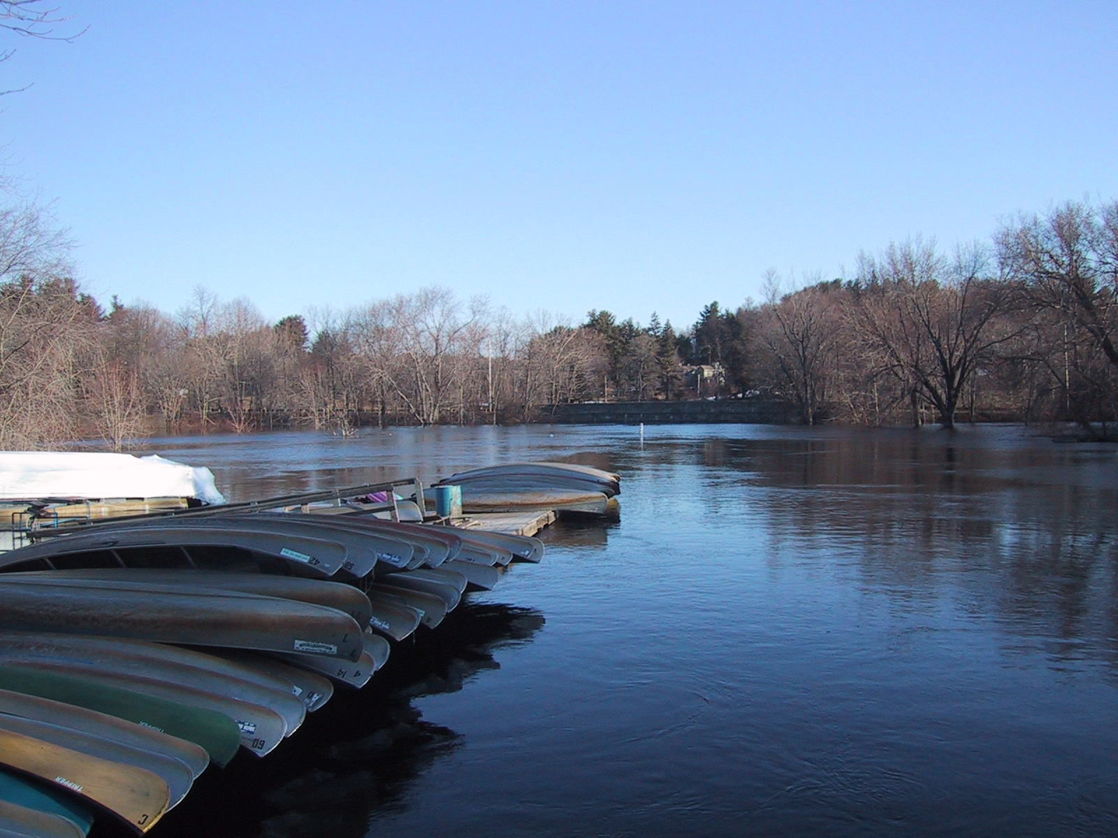 Looking north from the South Bridge, the canoe collection from the South Bridge Boathouse (which is surrounded on three sides by the flood, instead of the canoes being on the dock on the "shore"). Also notable is the next bridge northward (downstream) which is flooded up to the top of the arches. (Previous shots were taken from the upper left.)
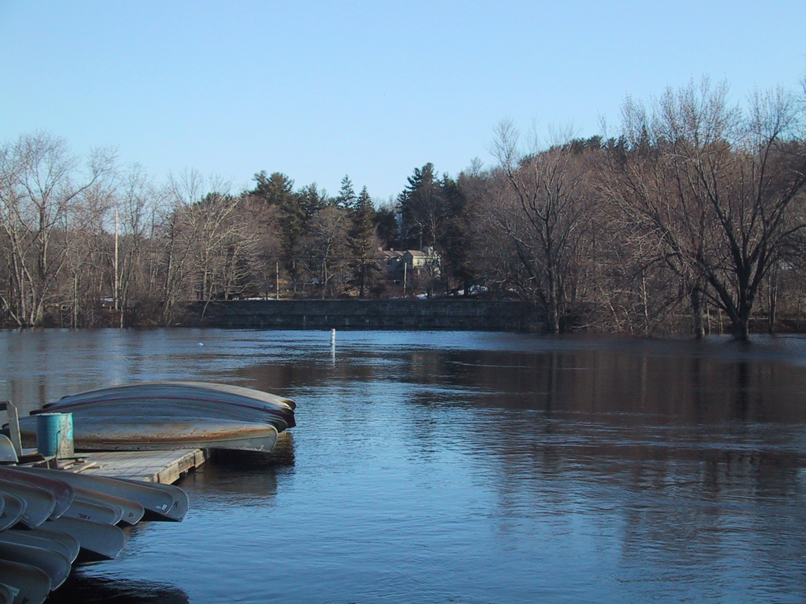 Still looking north, zoomed in to show the height of water on the Elm St. bridge.
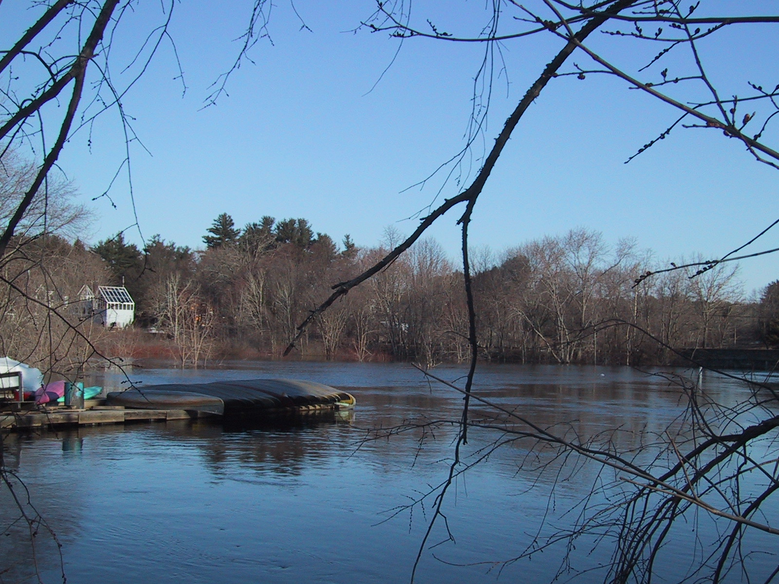 Looking to the northwest, from the eastern end of the South Bridge (note the canoes for reference, and the house on the left which is immediately adjacent to the where the east-facing river shots were taken.)
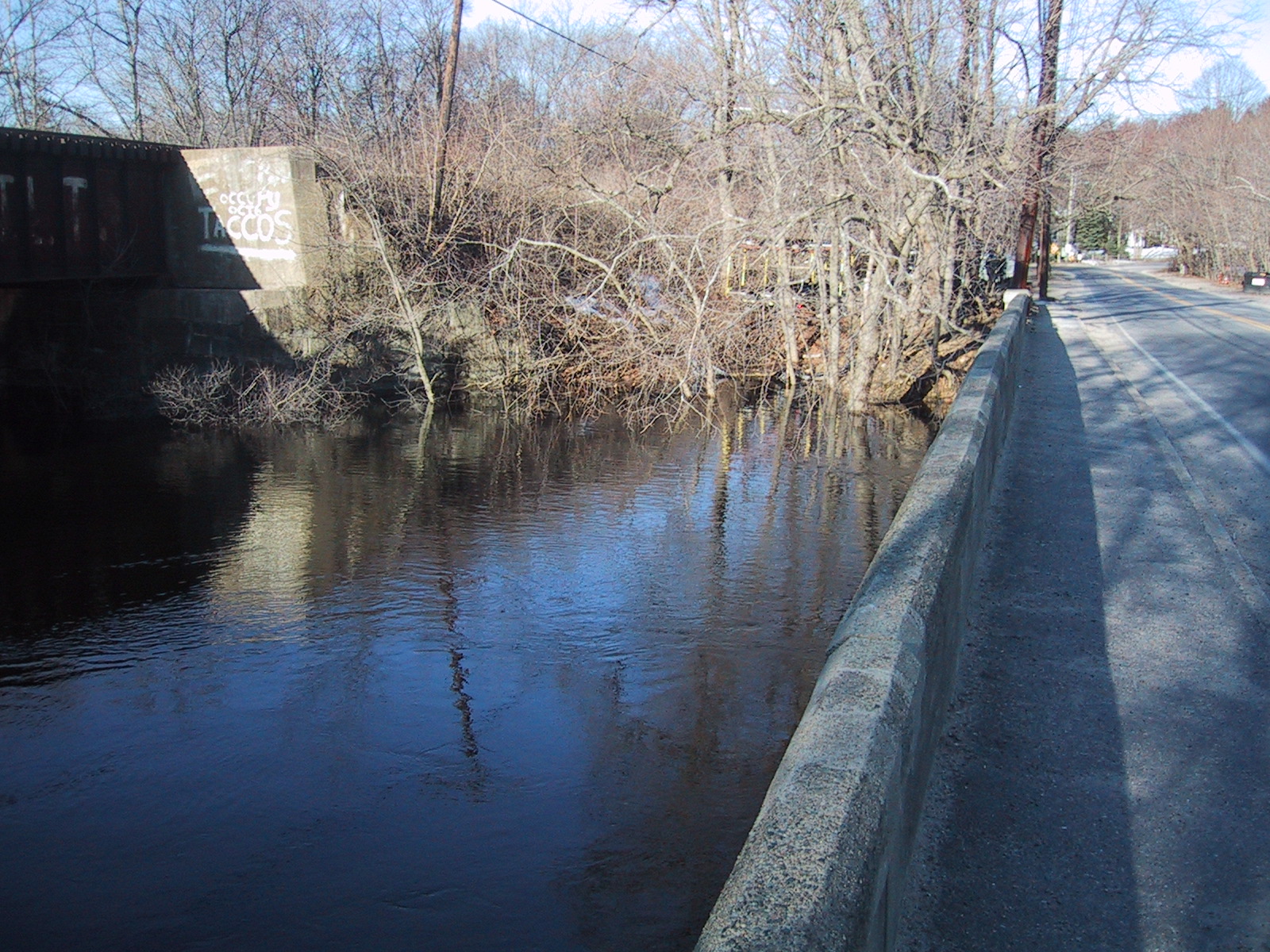 Looking west along the south (upstream) edge of the South Bridge; Commuter rail bridge to the left, and trees flooded above their forks in between.
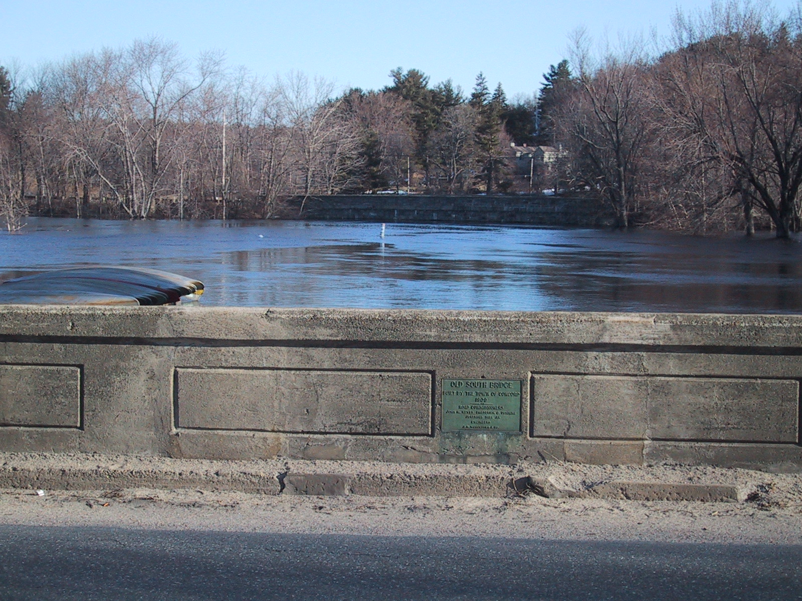 reference shot north-facing from the south edge of the South Bridge, showing the canoes, the next bridge, and the dedication plaque of the bridge itself.
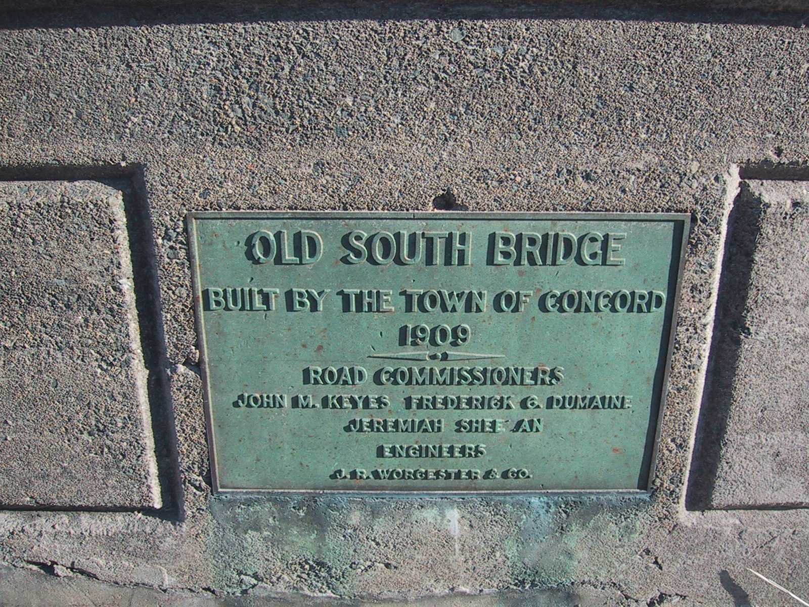 The Old South Bridge dedication plaque (on the north side of the bridge, there is a duplicate on the south side.) Text:
OLD SOUTH BRIDGE
Built by the Town of Concord
1909
The Old South Bridge dedication plaque (on the north side of the bridge, there is a duplicate on the south side.) Text:
OLD SOUTH BRIDGE
Built by the Town of Concord
1909
 Looking south from the east end of the South Bridge, showing the area under the end of the Commuter Rail bridge completely flooded (normally the left 3/4 of the space is walkable.)
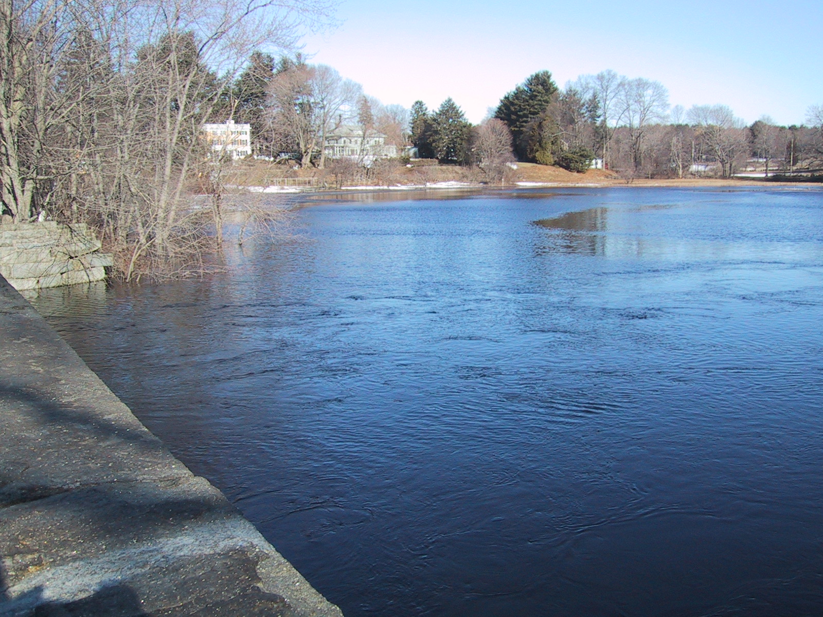 Looking northwest from the Elm St. bridge; this is usually a grassy/reedy area with a shoreline that starts at the stonework to the upper left.
 Looking northeast from the Elm St. bridge. The tree in the foreground is usually on the shoreline, with a lawn behind it.
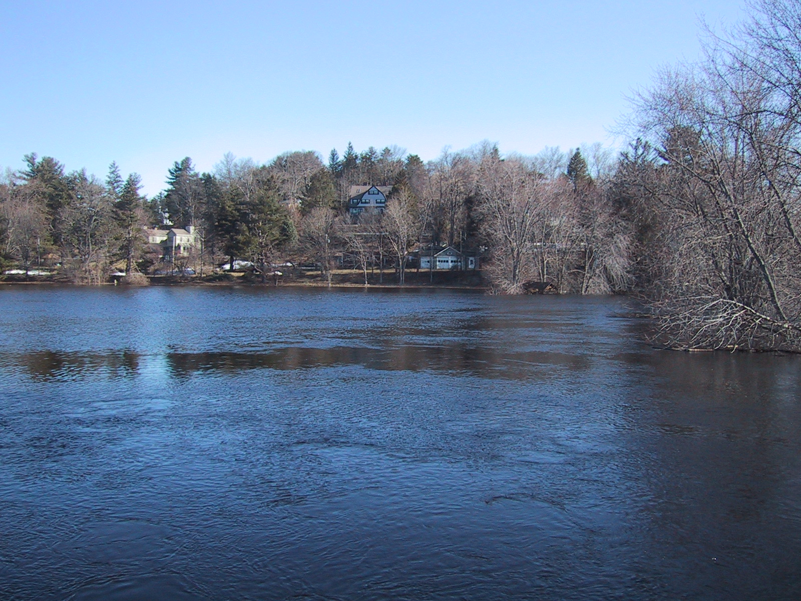 Looking north from the Elm St. bridge; normally the river just meanders through here, curving to the right.
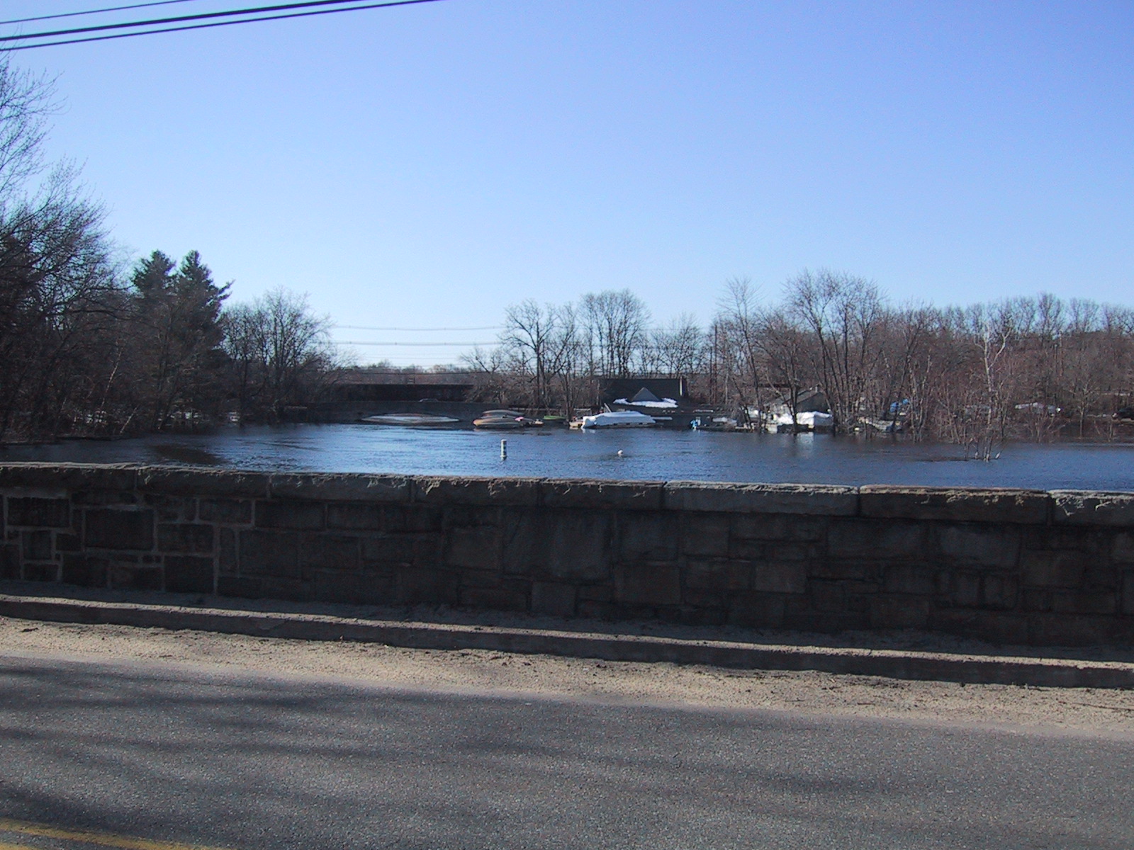 Looking south from the Elm St. Bridge across Elm St. at the Old South Bridge.
 Looking west along the south edge of the Elm St. bridge. This is back along the direction of the earlier shots, which were taken from the far end of the "inlet" visible to the left.
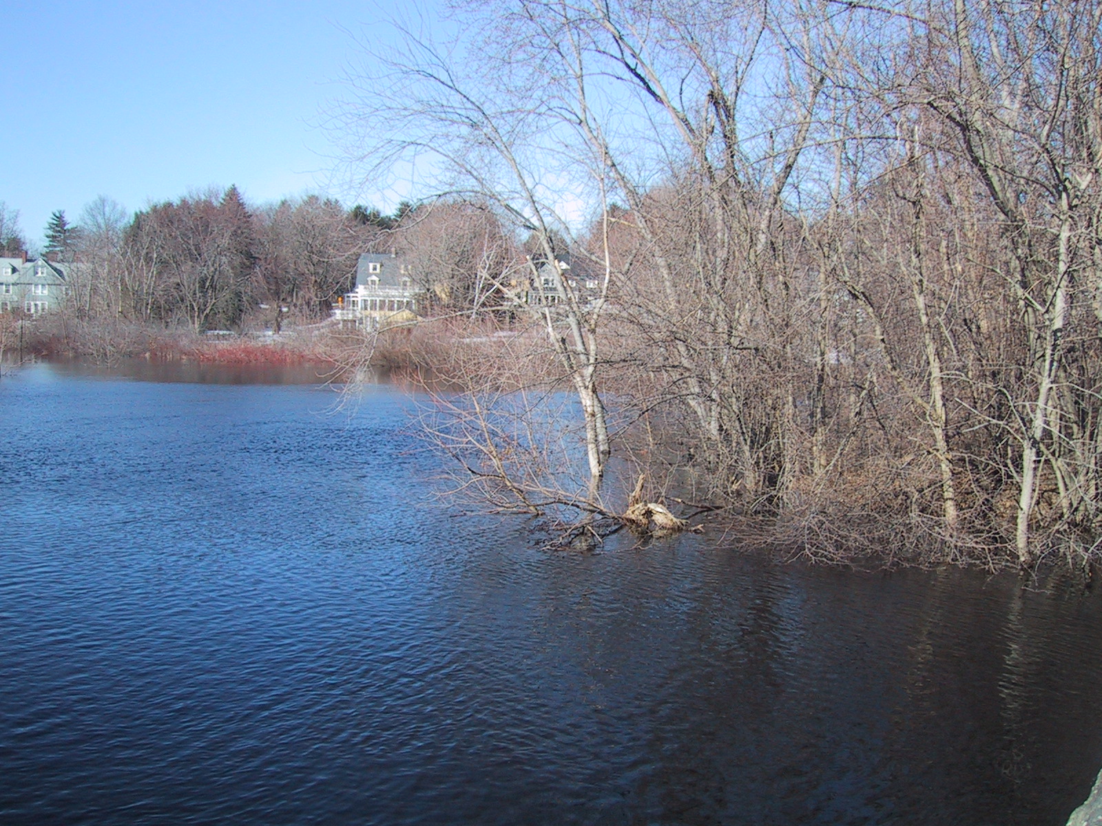 Looking to the left of the previous shot (looking southwest from the Elm St. bridge; the first run of pictures was taken facing roughly this direction from the center of this.)